Let's be honest, Doulgas, Wyoming is not exactly a major urban center. Nevertheless, it is the commercial and legal hub of Converse County and is the only thing vaguely resembling civilization in the area. As such, it's got its own unique and interesting history to learn and sights to see.
The afternoon after K and I arrived, we took the grand tour. Both MamaK and Roy have lived in and around Douglas for years and know all its nooks and crannies. Unfortunately, neither K nor I had our camera for that adventure, so you'll have to close your eyes and imagine.
But if you're at all familiar with West Virginia, here's a way to get your imaginings started. Douglass is a town of about 5000 people. It is also perfectly flat. Imagine a small West Virginia town, say, Grafton, had a giant hand pressed down upon it from above, completely flattening it out. It's no bigger than it once was, it just seems that way because all the mountains are gone. As a result, Douglas has amazingly broad boulevards for such a small towns. That made quite an impression on a guy whose dodged more than a small number of coal trucks on twisty two lanes getting in or out of said hillbound hamlets.
Douglas was born as a railroad town in 1886. At the time, it was the terminus of the Union Pacific. It still a railroad town, to a certain extent, but its importance to the area has diminished over the years. It's also the long time home of the Wyoming State Fair. Finally, it's the home to this disreputable critter:
The jackalope is a legendary creature that's a mix of jack rabbit and antelope. It probably stems from some sort of funky disease that the rabbits get every now and then, but that's not very entertaining. It certainly wasn't for the state of Wyoming, which designated Douglas the Home of the Jackalope in 1985.
Okay, I shouldn't have said "finally," because Douglas is also home to the Wyoming Pioneer Memorial Museum. Although the name suggests that it focuses only on the frontier days around the city's founding, it actually covers time periods up to the Second World War. It's focused on Douglas, of course, and has some really interesting collections. Here is your humble narrator, posing beside the original printing press from the weekly paper, the Douglas Budget: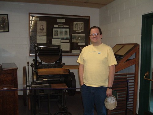
There's so much stuff packed into the museum, in fact (it also houses the Wyoming Pioneer Association archives), that it could use a reorganization/makeover comparable to what the West Virginia State Museum just wen through.
Although Douglas was founded in 1886, white settlement in the area predated that period. In 1867, the federal government built Fort Fetterman, about 10 miles outside of what would become Douglas, alongside the Bozeman Trail. It would be come a major jumping off point for several of the wars with the Native Americans, including the Black Hills War, which included the Battle of Little Bighorn (aka Custer's Last Stand). The fort was abandoned in 1882, leaving behind a civilian outpost dubbed Fetterman City. Fetterman City died a slow death once Douglas was founded.
Today, Fort Fetterman is a state historic site. All that remains is an officer's quarters (right) and ordinance warehouse (left), both given over to exhibits: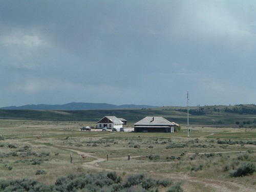
However, the rest of the fort's lands are part of the history sight, with identification and informational signs that guide you around what was once a parade ground and up on the high bluff from which that picture was taken. From there, you can look over the North Platte River, and the spot beside it where the saloons, whore houses, and the like sprung up.
While the rest of the group was checking out the indoor exhibits, I wandered around the parade ground up on the bluff. Luckily, I wasn't alone, as I had Sid, the site's resident border collie, with me: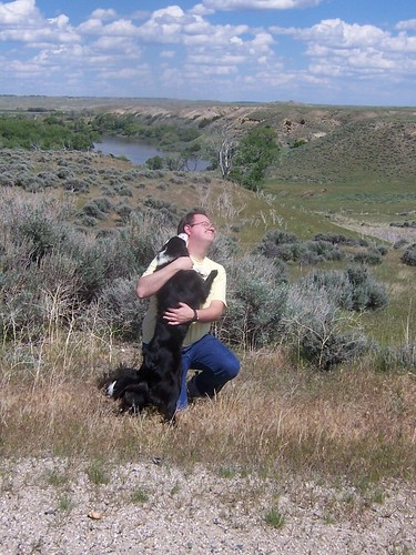
After Fort Fetterman, we headed off to see one of the area's natural attractions, Ayers Natural Bridge. About 15 miles from Douglas, it's a column of solid rock that arches out over a babbling brook. Here I am on the "front" side of the bridge: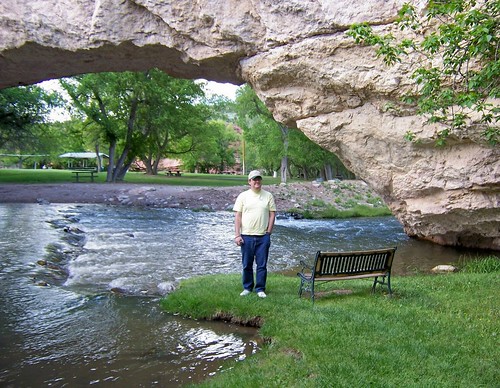
There's a very steep, narrow, rocky trail that leads up to the top of the bridge. The view is worth the short hike, but the route back down is pretty tricky. Needless to say, I'm proud of myself for making it back to ground level in one piece. Here's K on top of the bridge:
Here's another shot from the top of the bridge, down the valley of the stream. The building on the left is what's left of a power station that was built early in the last century.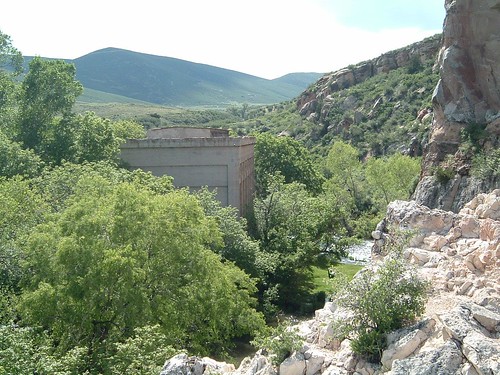
Here's a picture of the back side of the bridge (thankfully, there's an easy walk around, although you can trek down the steep path on both sides):
On the under side of this part of the bridge, dozens of birds (I can't remember what kinds) were using the nooks and crannies as places to build nests:
They were collecting mud from a small pool on the other side of the stream.
Speaking of the stream, take a close look at this picture. What do you see?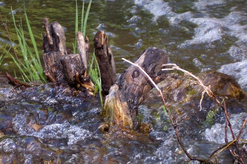
Looks sort of like a horse's head, sticking out of the raging rapids as the horse struggles valiantly to stay above the surface. Actually, it's just a cool looking stick. Neat, huh?
Ayers Natural Bridge has a whole host of park apparati to while away the time. That includes swings, of course. If K sees swings, she must partake (state law). I, of course, couldn't refuse the invitation to join her: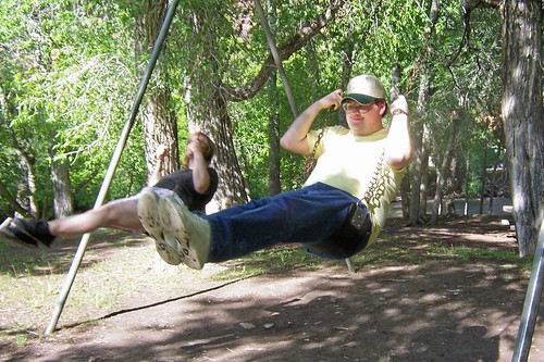
That was our day in and around the sights of Douglas. Tomorrow - I am forced to be crafty!
Thursday, July 02, 2009
The Douglas Chronicles: The Sights
Subscribe to:
Post Comments (Atom)


No comments:
Post a Comment